Rain, and Remarkable Finds: The Field Season Kickoff at Turpin’s Island
- Catherine Losier
- 1 day ago
- 6 min read

Week One of Memorial University's 2026 Field School on Turpin’s Island, Little St. Lawrence
The Department of Archaeology at Memorial University has just wrapped up its first week at Turpin’s Island for the 2026 season. A team of students led by Dr. Catherine Losier was able to open five test pits this week, most of which are showing promise and have already yielded several artefacts. Here’s a breakdown of what happened this week!

The crew arrived in the community on May 25th. We arrived late in the afternoon, so we ended our day with a collective supper of tacos made by Dr. Losier and a celebratory cake for dessert! After that, the group settled into their homes, gear ready, awaiting their first day on the field.


Fig. 2 The team gathering around a welcome cake to start the season, courtesy of Emma.
On the 26th—our first workday—it was pouring rain. The morning was spent in the lab, where we had a review on paperwork and lab procedures, and in the afternoon we took our first steps on Turpin’s Island. Touring the site in harsh weather taught us all the importance of waterproof (as opposed to water resistant) gear! Although it was exciting, everyone was thankful to dry off at the end of the day.

On May 27th, we were all relieved to see the sun. Since this field season began earlier than usual, the grass was shorter. This was helpful for surveying the site with the Ground-Penetrating Radar (GPR), done by Maria Lear, the Department of Archaeology’s geophysics specialist. Maria scanned with the GPR two big grids: one measuring 24 meters X 10 meters, close to the coastline to verify the presence of a potential building and a second grid, measuring 30 meters X 10 meters, to verify the presence of a potential features located east of a wall (feature 11) identify in 2025 probably built during the occupation of the site by Newman & Co. An additional benefit of the shorter grass was that it allowed the team to identify new potential features that are not visible when the grass is longer. Then, Dr. Losier demonstrated how to excavate test pits before sending everyone to work. Test pits 55, 56, 57, and 58 were started.

Another interesting find was a well, previously unseen due to the tall grass. Locals had been mentioning a well on Turpin’s Island, but it was never found by archaeologists until this year. Later in the week Kayla and Calum removed the moss on some of the stones surrounding the south side of the well, and it yielded one fragment pearlware. More information about this find will hopefully come soon! We wonder when the well was lined with stones, by which Turpin occupants.


Fig. 6 Kayla and Calum exposing the stones surrounding the southern side of the well

The first test pit of the season, number 55, was excavated by Liam and Taylor. The objective was to verify the presence of a potential feature (perhaps a building that we are seeing on a map of 1860-1861. They uncovered two pipe stems and three sherds of ceramic, but no evidence of the feature was identified.
Once they reached the natural soil, they drew the stratigraphy, which illustrate the different soil layers identified while digging. Stratigraphy helps archaeologists visualize the accumulation of soil layers (cultural and natural) and anthropic (human-made) features found during excavation, and to link these features and layers to the artefacts unearthed from them.

Test Pit 56 was excavated by Jason and William S. It is located near the beach in what we refer to as the “French sector” of the site, close to the southernmost stage (stage 1). Jason and William S. uncovered numerous fragments of basque clay tiles, pipe fragments, glass, nails, ceramics, and even Normandy stoneware made in France! In general, soil deposits in this area are quite thick. For example, this was the case in Test Pit 36, excavated by Skyler in 2024, in which a layer rich in cod bones was discovered 82 centimetres below the surface. By the end of the week, Jason and William S. were still excavating Test Pit 56. Stay tuned for next week's blog post to learn more about their discoveries!
Cole and Matt dug test pit 57 on the edge of a depression and found a stone feature. The test pit is located north west of stage 1. The few artefacts recovered so far from the test pit date to the 19th and 20th centuries. At present, we do not yet know what the stone feature represents, whether it is a building foundation or cobbled stone used for drying cod. We should know more in the coming days!
Test pit 58 was started by Jennifer, who was later joined by Kristin. This test pit is located immediately south of Feature 4, a building associated with Newman & Co fishing premise. The test pit exposed a stone wall built alongside natural bedrock. Along with the wall, the test pit also contained nails, glass, ceramics, and most notably a fragment of an animal bone which belonged to a large mammal, possibly livestock! The pearlware ceramic found in the test pit can be associated with the occupation of the site by Newman & Co. (1784 and 1810), this wall seems to be associated with the other Newman & Co. features present in the sector.


Fig. 9 Left: The stone feature found in Test Pit 57; Right: Kristin and Jennifer excavating Test Pit 59
Work on the final test pit for this week began on Thursday. Test Pit 59 is located alongside another depression just east of Stage 1. This test pit is being excavated by William C. and Emma. Large rocks were identified as soon as the sod was removed. The rocks and bricks uncovered during excavation are consistent with a possible feature. Alongside these were fragments of brick and mineral coal, which could be associated with the Newman & Co. occupation (1784–1810) or with Newfoundland families (Thorne or Turpin) during the 19th and 20th centuries. It must also be mentioned that a fragment of Breton earthenware (made in Brittany, France) was recovered; this ceramic is typically associated with the French occupation of the site. The reason this sherd was found in a more recent context may be due to disturbance of an earlier (French) archaeological deposit. Disturbances and reoccupation are to be expected at a site occupied by different groups over a span of 500 years.

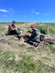


Fig. 10 Emma and William C. excavating Test Pit 59 and student looking for artefacts in the sifter
The work week ended in the same fashion as it started: a rainy day. We spent our morning in the lab cleaning the artefacts that we found. The group was all together in one room, which helped forge bonds and boost team morale. After the lab day, everyone decided to get together and go to Smugglers Cove for some supper. The food was delicious!


Fig.11 Lab day at the end of week one
Saturday arrived quickly, and as it was everyone’s first day off, it was time to go exploring around the Boot! Dr. Losier went to catch some waves at Shoal Cove beach, and Emma decided to take a trip over to Tides Cove Point lighthouse. She was met with a beautiful view, along with some friendly goats! The rest of the group hiked Chapeau Rouge. It was a beautiful but windy hike. The view was worth the wind!


Fig. 12 Saturday activities
Do not forget to come visit us folks! We are alway delighted when people come see, we love to share what we are learning about the archaeology and history of Turpin's Island!
Bonus: Extract from an anonymous world map held at the Vatican Library (Urb. lat. 274), dating from 1530, showing Terra delosa Bacalaos (Newfoundland) and P.S. Lorenzo. At present, this is the oldest known map on which the toponym St. Lawrence appears. It dates just 33 years after John Cabot’s famous voyage of exploration in 1497. This serves as a testament to the importance of the Chapeau Rouge region during the early European occupation of Newfoundland. This map was found by Kassandra Drake, Memorial student, who wrote her master thesis on Turpin's Island, read it here.

References:
● Drake K.L. (2026). « An investigation of human activity and environmental change at Turpin’s Island through palaeoenvironmental and historical archives », MA thesis, Memorial University
● Losier, C., Ledger, P., Whitridge, P. (2024). “Turpin’s Island, Little St. Lawrence, CfAu-05. Small Scale Archaeological and Paleoenvironmental Excavation” Provincial Archaeology Office 2023, Archaeology Review, Vol. 22, p. 95-109.
● Losier, C. (2025).“Turpin’s Island, Little St. Lawrence, CfAu-05. Survey and Identification of Features”. Provincial Archaeology Office 2024, Archaeology Review, Vol. 23, p.188-201.
● Losier, C., Drake, K., Burgess, N. (2026) “Turpin’s Island, Little St. Lawrence, CfAu-05. Scaling Up Data Collection. Memorial University Field school 2025”. Provincial Archaeology Office 2025, Archaeology Review, Vol. 24, p.39-54.
Authors:


Comments