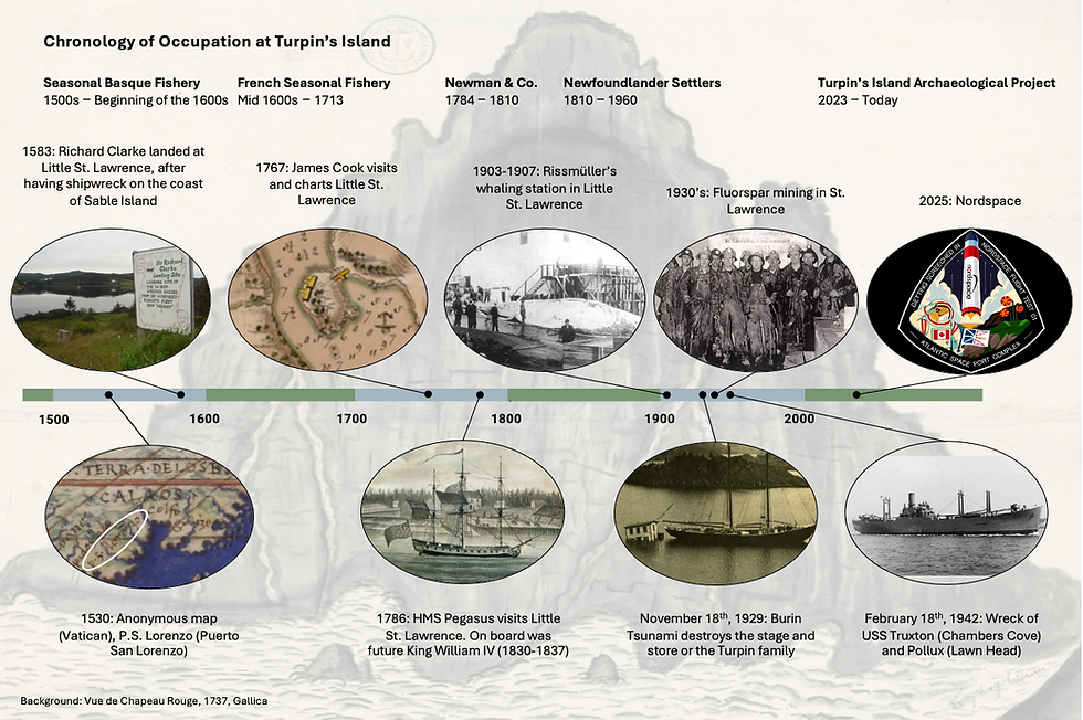
Exploring the Past, One Layer at a Time: Memorial Archaeology Returns to Turpin’s Island!
- Catherine Losier
- Jul 1, 2025
- 5 min read

Week One of Memorial University's 2025 Field School on Turpin’s Island, Little St. Lawrence
The Memorial University’s Department of Archaeology field school, conducted by Dr. Catherine Losier, has returned to resume excavations on Turpin’s Island in the community of Little St. Lawrence. We are excited by the opportunity to work with such an amazing community again as we excavate the rich history of Turpin’s Island. Here is the tale of our first week on site!

After arriving in Little St. Lawrence on a foggy Monday, June 23rd, 2025, we settled at our accommodations and gathered for the first of many family meals; a team of 15 makes for a big family! Fieldwork began on Tuesday, June 24th, and after a morning of touring Turpin’s Island and learn more about the site, the trowels came out and excavations began in an attempt of better understanding the 500 years of Turpin's Island occupation. Our first week here has been quite eventful!

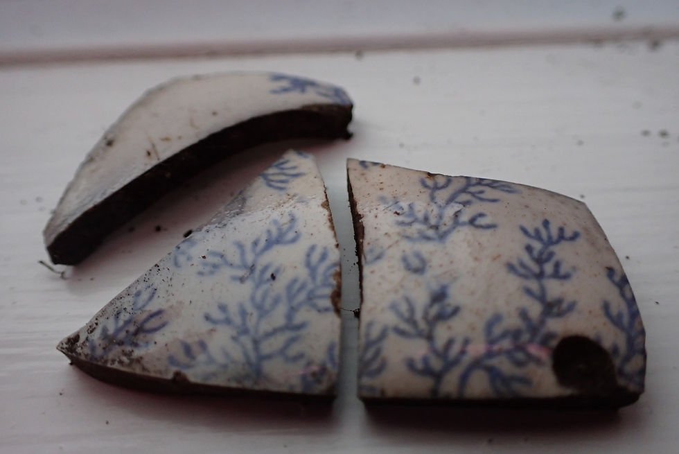
By the end of the day Tuesday, students began uncovering their first artefacts including: tobacco pipe and ceramic fragments, broken window sherds from the Turpin’s house, and lots of iron artefacts (scientific way to say nails!) that will be analyzed in the lab next week!


Fig. 3 James showing a pipe steam and Catherine a nail
On Wednesday, new artefacts were being excavated, bagged, and tagged: 18th century wine glass, ceramic pipe stems, and Basque tiles were among the most exciting finds. Students also learned how to analyze soil accumulation in their test pits and draw stratigraphic profiles.
As Thursday rolled around, some students moved on the drawing of the stratigraphy of their test pits as they reached the natural layer of the site. Natural means that no human activities can be identified in this layer. Thursday afternoon the finished test pits were flagged off and fresh test pits were opened. Other students learned how to use the RTK (Real-Time Kinematics) with Valentin de Filippo. The RTK is used to determine the exact location and altitude of each test pit, and to accurately calculate the depth we reach in the test pits.

During the first week, the team opened 12 test pits, a very impressive pace for a group of new archaeologists! James excavated the first test pit (#43) of the season, in order to better document the stratigraphic accumulation in Feature 3 that is associated with the tenure of the land by Newman & Co. Maya and Sanaa excavated Test Pit #44 to document a trench located on the northern tip of the island, and while the function of this trench is still unknown, it was full of mineral coal and artefacts are consistent with a late 18th – early 19th century occupation.
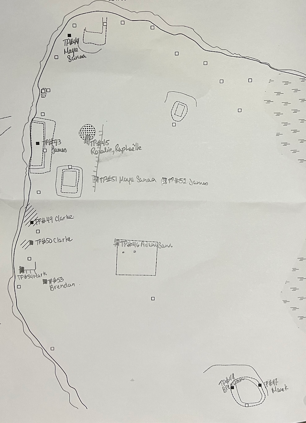
A team of two students from the Université de Montréal who have joined the Memorial field school for the summer, Rosalie and Raphaëlle, and are working in Test Pit #45. Starting with a classic test pit of 0.5 by 0.5 meter, they extended it to reach 1 by 0.5 meter to gain a better understanding of an intriguing conical rock pile. The goal is to determine if it is a feature, and if so, its function and construction date. At the end of the excavation on Friday we think that it is a feature, but what? We are on the edge of our seat with this one!


Fig.6 Sanaa and Maya excavating in a trench; Raphaëlle and Rosalie excavating in the conical stone pile.
Test Pit #46 is located along the north wall of the Turpin house and is excavated by Adam and Sam. So far, the test pit has yielded dozens of sherds of window glass, nails, pottery sherds, chunks of brick and mineral coal, and most recently a bone button! Toward the base of their test pit, they uncovered what appears to be a structure of large stones, maybe the foundation on which the Turpin’s house (feature 7) was built. They spent Friday drawing a map of the stones, before they will remove them. Mark and Brendan each opened test pits (#47 and #48) in Feature 5. This feature is giving us a hard time as almost no artefacts were found or any structures. We cannot date or determine its function now.

On Friday, the wind picked up and everyone hunkered down in the long grass around their test pits to avoid the gusts blowing dirt and dust into our faces. Clarke, Brendan, and Mark opened test pits in the area of the site associated with the French occupation (before 1713). These test pits (#49, #50, #53 and #54) are helping to set the borders for a planned larger excavation early next week by testing where the stratigraphy is changing and determining where structures may have been. We think we have identified a new feature (a platform or a wall) that Mark is currently investigating, so exciting! More to come in next week’s post!

Maya and Sanaa opened Test Pit #51, near the test pit excavated by Raphaëlle and Rosalie. The objective of Maya and Sanaa is to document a rock wall that seems to retain a terrasse or could be associated with a building; only excavation will give us the answer (fingers crossed!). Directly east of Maya and Sanaa’s second test pit, James opened Test Pit #52 on the top of a hill. We hope to be able to say more on this test pit in the next blog post.
On Friday morning, Rosalie and Catherine gave a radio interview (in French) during the morning show Le réveil Nouvelle-Écosse et Terre-Neuve at CBC/Radio-Canada
We finished off our week with a small birthday party for one of our teammates, Adam! The delicious chocolate cake was cut, in true archaeological fashion, with a (mostly) clean trowel. The celebrations continued into the evening with a visit to Smugglers Cove in Burin for dinner and drinks! With a strong focus on excavating the northwest side of the island this year, the good weather this week has given us an excellent start to the season and things are progressing quickly!


Fig. 9 Happy Birthday Adam!
The team had the weekend off and they participated various activities around Little St. Lawrence and St. Lawrence: BBQing, hiking Chapeau Rouge, attending the second half of the Saturday soccer game, relaxing and surfing at Shoal Cove beach. Everybody had a great weekend and enjoyed themselves. Raphaëlle reported that she had never seen as much green as she did on her hike to Chapeau Rouge! Special mention to Maya, Raphaëlle, Clarke and Valentin who bravely went for a brief and refreshing dip at Shoal Cove!


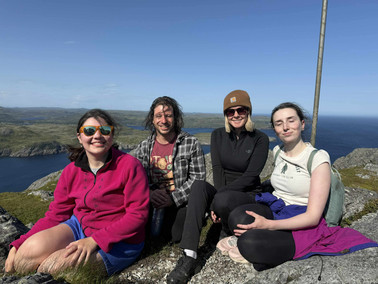


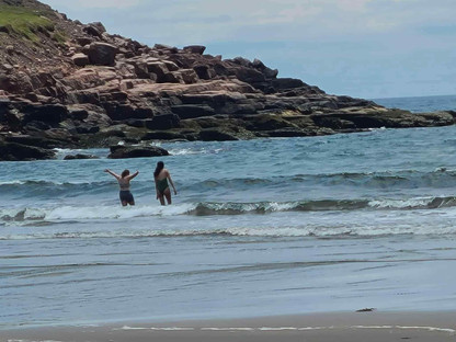


Fig. 10 James, Rosalie, Anna, Valentin, Cassy, Kayla on top of Chapeau Rouge; testing the water at Shoal Cove; Catherine on a hike

Stay tuned for the next blog post and the artefacts of the week series. The site is open to visitors, and we would love to see you out there! Weather permitting we are on site 8:30am - 4:30pm Monday to Friday! Follow the signs from Highway 220 in Little St. Lawrence and we hope to see you soon!
References:
Losier, C., Ledger, P., Whitridge, P. (2024). “Turpin’s Island, Little St. Lawrence, CfAu-05. Small Scale Archaeological and Paleoenvironmental Excavation” Provincial Archaeology Office 2023, Archaeology Review, Vol. 22, p. 95-109.
Losier, C. (2025).“Turpin’s Island, Little St. Lawrence, CfAu-05. Survey and Identification of Features”. Provincial Archaeology Office 2024, Archaeology Review, Vol. 23, p.188-201.
Authors: Clarke Simonsen, Raphaëlle Gascon, Sam Gregory


Looks like an excellent time! Happy Birthday Adam!!!!!