From Lab to Landscape: Week Three of Field Work at Turpin’s Island
- Catherine Losier
- 2 hours ago
- 8 min read

Week Three of Memorial University's 2026 Field School on Turpin’s Island, Little St. Lawrence
Week Three begins on Monday, June 8, 2026, with a busy laboratory day for all students. They begin the careful work of cleaning, sorting, preserving, and photographing each piece of Turpin’s Island's historical mysteries. Sitting together around a large table, they sort through artifacts, associating them with the layers and test pits from which they were recovered. When it comes to artefacts the context of discovery is everything!
The laboratory procedure is highly detailed and requires students to preserve artifacts in different ways depending on the materials from which they are made. Metals such as iron or lead alloys are placed in bags filled with water, whereas ceramics, glass, and bones are washed, dried, and stored in dry bags. Once the students have properly labelled their trays for each layer, they carefully bathe each artifact in water to remove excess dirt from each individual piece.


Fig. 1 Lab work, washing artefacts
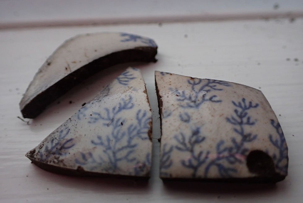
The laboratory becomes especially exciting when students discover ceramic sherds. PhD students Kayla Low and Calum Brydon, who specialize in colonial material culture, help with the identification process. For example, Kayla and Calum examined pottery sherds under microscopes to study the distinctive minerals within the fabric of the pottery. A ceramic sherd recovered from William Chafe and Emma Turner’s Test Pit 59 during Week One was identified as a Pabu French ceramic artifact, based on the unique composition of the pottery fabric. This type of analysis helps highlight the regions from which Atlantic mariners originated before settling on Turpin’s Island. In addition, common designs and colours on ceramic fragments can help identify the time period in which they were made.
As noted above, the context in which artifacts are discovered is of critical importance, and each test pit typically contains between two and five layers. On the field changes between layers are identified through variations in soil characteristics, including differences in colour, texture, and composition (for example, variations in sand, silt, or clay content).

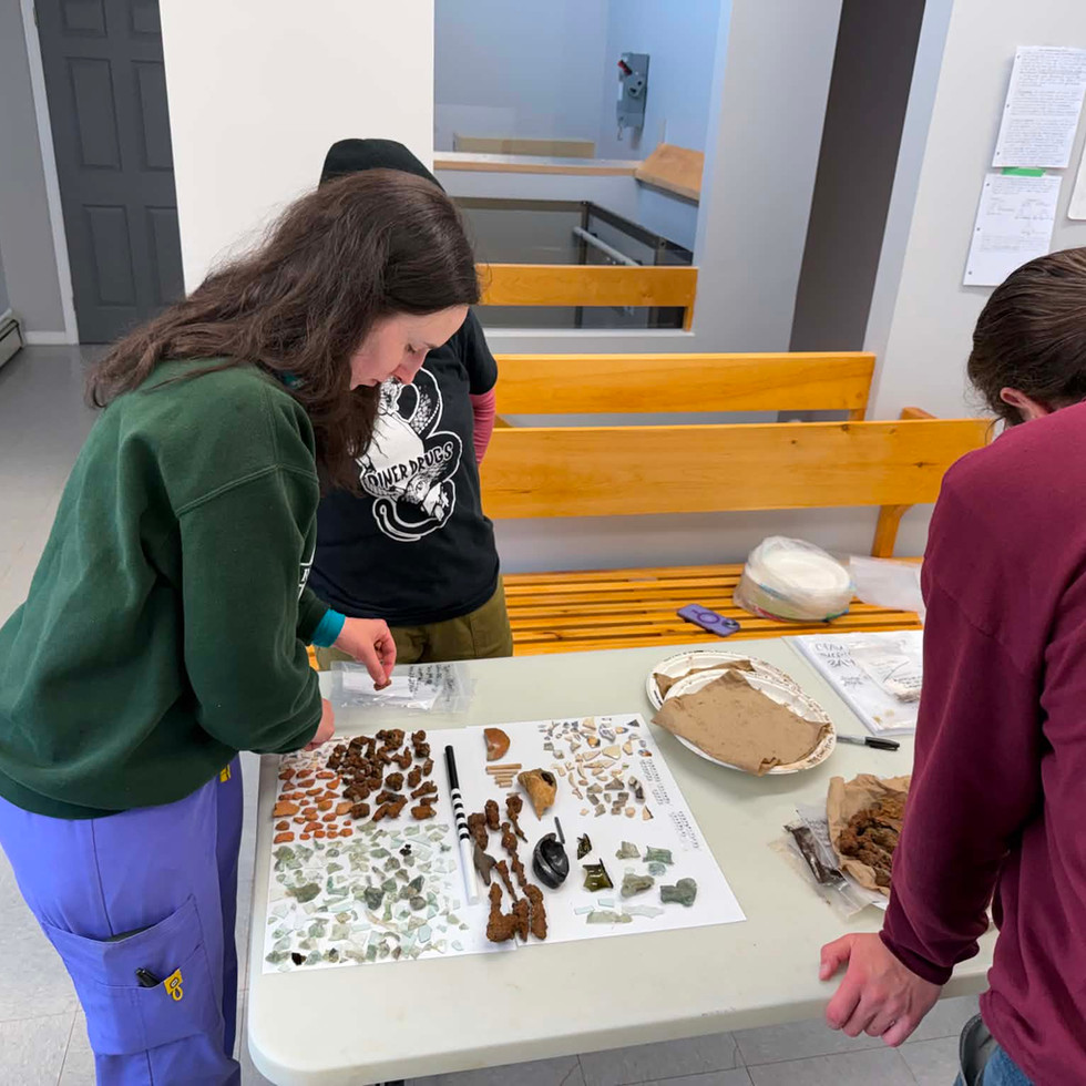

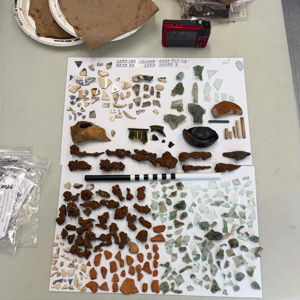
Fig. 2 Preparing artefacts for picture of layer 2 in Test Pit 58
Careful observation of these stratigraphic changes enables us to distinguish between deposits that have been created or altered by human activity, such as deliberately placed stones, and those that are naturally occurring geological formations. These distinctions allow archaeologists to document different contexts and to better understand the various periods of site occupation. Artifacts recovered from each layer helps dating these contexts and associating them with the diverse cultural groups that have settled at Turpin’s Island over the past 500 years.
The students of the Turpin’s Island 2026 field school also enjoy exploring local restaurants. One of our favourites is the Lunch Tin Café. The building also houses the St. Lawrence Miner’s Memorial Museum, a must-visit when in Great and Little St. Lawrence. We all enjoyed a homestyle meal to take a break from the laboratory day. The team enjoyed warm soup, sandwiches, and cheesecake, which certainly lifted everyone’s spirits. Several students are still talking about how delicious the cheesecake was and are already looking forward to another visit before the field season comes to an end.

Prior to the field school, students learned about Chapeau Rouge and Turpin’s Island, but nothing compares to walking the landscape and observing the geography of Great and Little St. Lawrence in person. With both the theoretical knowledge gained in class and the practical, hands-on experience of excavating test pits on Turpin’s Island, we now have a more comprehensive understanding of this complex landscape. The island is no longer seen as a two-dimensional map, but rather as a dynamic cultural landscape shaped by Newfoundland’s North Atlantic maritime history. This perspective becomes increasingly clear with each day spend in the field. This week, we have chosen to describe the excavations by following the trail that leads to the site. Follow the trail!

Fig. 4 Map of the site with some of the Test Pits excavated in 2026
Matt Williams and Cole O’Brien opened a new test pit (64) on the northwest side of Turpin's. The goal of this test pit is to investigate a feature visible in the 1786 drawing of the Newman & Co. fishing station by James S. Meres. Although many test pits were excavated in this area in 2024, no feature was clearly identified at that time. In this case, the excavation was placed near a section of shoreline where slag (a byproduct of metalworking), nails, and slate had been eroding. Just beneath the sod, Matt and Cole uncovered a man-made feature, which is an exciting development. Our working hypothesis is that this isolated structure may have been a blacksmith’s building. We will continue to evaluate this interpretation based on any artifacts associated with the feature as the excavation progresses.

Fig. 5 View of the Pegasus in front of Newman & Co. fishing premise with the building in the area of Test Pit 64 in purple; the raised platform that could be associated with unit 3A in orange
Following the trail westward two stone features can be seen along the coastal beach at low tide. These structures once supported fishing stages associated with both the French occupation and the later Newman & Co. presence on the island. Working carefully on Feature 3, Taylor Ford and Jason Kean are continuing the excavation of Unit 3A, which was begun in 2025. This remarkable feature appears to be the base of a platform or flake (used for drying fish) surrounded by a drain. The drain itself was excavated in 2025, and Taylor and Jason are now focusing on both the interior and exterior of the feature to better understand its function. This area of the site is particularly rich in artifacts. To date, numerous sherds of pearlware, pipe stems, nails, and other metal items, such as watch winders, have been recovered, all dating to the period of occupation by Newman & Co.


Fig. 9 Excavation in 3A and drain
Thanks to lower vegetation this year, we were able to make another interesting observation. It appears that Newman & Co. invested considerable effort in managing water around their buildings and structures. A drain was identified in Test Pit 58, located south of the house (Feature 4) also a Newman & Co. building. Another drain is situated north of the stone oven (Feature 8), and a third drain, in which many Newman & Co. era ceramics, was found was identified in 2024 (Feature 9). These efforts toward water management are particularly interesting.
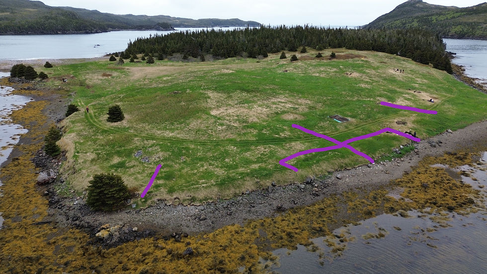


Fig. 10 Aerial picture and sketch of the drains in the Newman & Co. sector of the site and drain in Test Pit 58
Continuing closer to the southern stage, we visit Matt and Cole’s Test Pit 57. Their excavation revealed Feature 15 and Feature 16, possibly cobbled areas separated by a path. One hypothesis is that the stone features located to the north and south of the trench may represent graves (the French term for cobble drying platforms). The central portion may indicate a pathway running between these features.


Walking south, we reach William Chafe and Emma Turner’s Test Pit 59, located east of Stage 1. This test pit is thought to represent a workshop or storage structure associated with the twentieth-century occupation of the site. Due to the limited number of artifacts recovered, the feature is difficult to date with certainty; however, the presence of bricks suggests a more recent construction. William and Emma concluded their excavation by producing a detailed drawing of the feature as well as the stratigraphy of the test pit.
Continuing up the southern hill, we arrive at Test Pit 62, where Will Squires and Liam Bowes are excavating a feature set into the hillside on the east and south sides. Within this feature, a layer of small pebbles appears to form either a floor or a drainage system. The structure is visible in the landscape as a rectangular depression, and many questions about its function remain. Analysis of the associated artifacts will help provide a clearer date for this context; however, at present, it is thought to have been built in the nineteenth or twentieth century and is therefore likely associated with the Thorne or Turpin occupation of the site.


Fig. 13 Test Pit 62
A short walk over the hill to the northeast of Will and Liam’s unit brings us to Kristin Cooper and Jennifer Colbourne’s Test Pit 63. Located at the base of the hill, this test pit was initially thought to be a possible latrine associated with the Turpin occupation. However, once Kristin and Jennifer began excavating Layer 2, they uncovered a stone feature and a posthole surrounded by rocks, indicating that it was not a latrine. After examining a 1949 aerial photograph and analyzing the topography of the area, we now believe that this feature is associated with the Turpin family barn. The test pit also revealed a particularly intriguing find: within the sandy fill of the posthole, Kristin and Jennifer recovered a seventeenth-century pipe bowl, likely of Dutch or French origin, featuring the profile of a distinguished gentleman. We believe the sand used to fill the posthole was collected from the beach and that the pipe bowl was accidentally included in that material. The presence of flint, also commonly found along the beach, supports this interpretation.


Fig. 14 17th century pipe bowl found in Test Pit 63
The wealth of archival documentation, historic maps and drawings, as well as photographs and community knowledge, combined with archaeological data, makes research at Turpin’s Island particularly engaging. By drawing on information from the past, we are able to piece together 500 years of history in the Chapeau Rouge area. So far, our research has allowed us to better document the Basque presence, the French occupation up to the signing of the Treaty of Utrecht, the Newman & Co. fishing premises (1784–1810), as well as the nineteenth- and twentieth-century Newfoundlander occupation of the site.
As our third week came to a close, the 2026 Turpin’s Island Field School team packed up their bags and eagerly headed to Bay de L’eau, just outside of Marystown, where Emma’s family owns a lovely cabin. The team unwound by the lake—kayaking, fishing, and even climbing a majestic waterfall—before wrapping up a fantastic weekend around the fire, cooking s’mores and sharing laughs over ghost stories. Chef Liam dedicated an entire evening to spoiling us with homemade dumplings from scratch (yes, even the dough)! We are so grateful for such a wonderful team and are really starting to feel like a family. It is hard to believe there is only one final week left in our adventure together. Stay tuned for our final update from the 2026 Turpin’s Island journey!


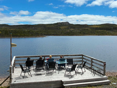


Fig. 16 Weekend at Bay de L'eau

Do not forget our community presentation on Thursday, June 18 at 7:00 p.m. at the St. Lawrence Recreation Centre. We will be sharing updates on our exciting progress at Turpin’s Island and showcasing some of the most interesting artifacts discovered this season.
Bonus:
Catherine Losier, Interview at the Broadcast, June 17th 2026. Inteview begins at 11:54. https://www.cbc.ca/listen/live-radio/1-122-the-broadcast/clip/16221231-a-liberal-mp-critical-dfo-dividing-northern-cod
References:
● Drake K.L. (2026). « An investigation of human activity and environmental change at Turpin’s Island through palaeoenvironmental and historical archives », MA thesis, Memorial University
● Losier, C., Ledger, P., Whitridge, P. (2024). “Turpin’s Island, Little St. Lawrence, CfAu-05. Small Scale Archaeological and Paleoenvironmental Excavation” Provincial Archaeology Office 2023, Archaeology Review, Vol. 22, p. 95-109.
● Losier, C. (2025).“Turpin’s Island, Little St. Lawrence, CfAu-05. Survey and Identification of Features”. Provincial Archaeology Office 2024, Archaeology Review, Vol. 23, p.188-201.
● Losier, C., Drake, K., Burgess, N. (2026) “Turpin’s Island, Little St. Lawrence, CfAu-05. Scaling Up Data Collection. Memorial University Field school 2025”. Provincial Archaeology Office 2025, Archaeology Review, Vol. 24, p.39-54.
Authors:


Comments